
Cape Tribulation
With its main road access being on the Daintree River ferry, Cape Tribulation is a small settlement within the Daintree area, having licensed accommodation, shops and restaurants as well as having a wide beach and prominent headland. Daintree Village is on the other side of the river.
The Daintree National Park is in the Wet Tropics World Heritage Area and has two sections –Mossman Gorge and Cape Tribulation.
This area was called Goolkey, or Kulki, by the traditional owners, the Eastern Kuku Yalanji Indigenous people. Their tribe was the Jungkurara. They camped here and travelled between Mossman (70 km south) and Wujal Wujal, (35 km north), so there was already a well-used track from Cape Tribulation to the Bloomfield River when white settlers arrived.
The rainforest does actually meet the Great Barrier Reef at South Myall (Coconut) beach.

(1973). Scenic - Queensland - Cape Tribulation north of Queensland.
1770
Jun 11 / Lieut James Cook’s Bark Endeavour struck the Great Barrier Reef north-east of Cape Tribulation just before 11pm, and seven days later after bad weather, they limped into Cooktown to make repairs. Lieutenant Cook named Cape Tribulation because ‘here began all our troubles’.
1843-1845
Captain Francis Price Blackwood in the sloop HMS Fly, accompanied by Lieutenant Charles Yule in the cutter Bramble, performed a reasonably detailed survey of the waters and reef off Cape Tribulation.
1848
The pyramid-shaped mountain behind Cape Tribulation was named Mount Pieter Botte by Captain Owen Stanley of HMS Rattlesnake because he thought it looked like the Pieter Botte on the island of Mauritius, East Africa.
1873
Dec 6-7/ George Augustus Frederick Elphinstone Dalrymple, a Scotsman, named the Daintree River for his friend Richard Daintree, the former Government geologist, then Queensland’s Agent General in London. The 4500ft mountain behind the Heights of Alexandra, he named Thornton Peak, to honour William Thornton, Collector of Customs.
1877
The Daintree was opened up for selection.
1932
Jan 1 / Dave and Annie Mason arrived in Cape Tribulation. The Mason family were the first white settlers, having first farmed in Cow Bay (then known as Baileys Creek) in 1927.
At the time of arrival, Walter (Col) Mason reported that more than 300 local Indigenous lived along this coast.
1934
A cyclone left ‘only one banana upright’ – wedged in the fork of a tree.
1937
There were six settlers and their children living here. A parcel of meat arrived weekly on the Cairns-Cooktown boat.
WWII (1939-1945)
There was a Volunteer Defence Corp base. Andrew Arthur and Col (Walter senior) Mason farmed right through the war years, supplying the troops.
Land Army girls provided the labour.
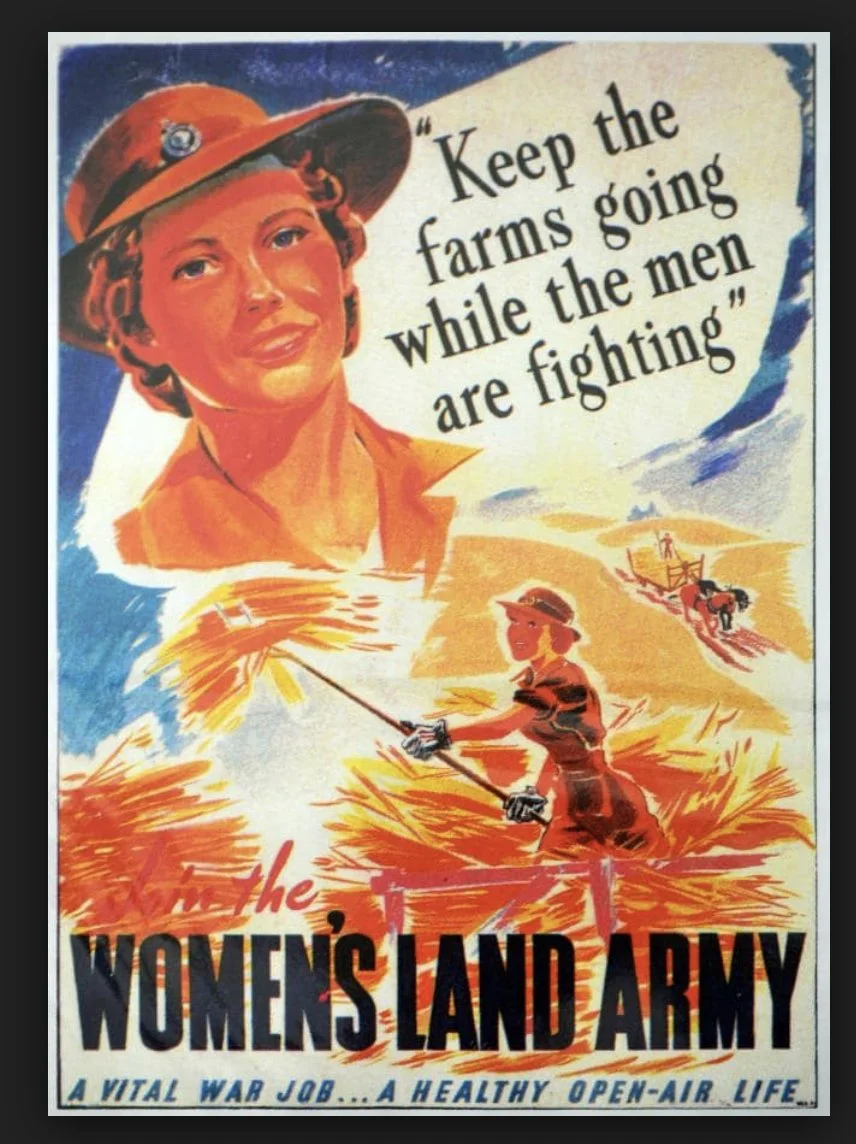
Land Army poster
1945
A weekly motor vessel from Cairns delivered mail on the way to Cooktown and loaded fruit (bananas, tomatoes, passionfruit, mandarines and pineapples) on the way back. Wild pigs and bandicoots were problems to the farmers. The only roads were internal farm tracks. There was no running water or electricity.
1949
Oct / Walter and Myrtle Mason moved south and attempted to grow rice on the bank of Hutchinson Creek.
1952
The Masons ran a sawmill from after WWII until about 1963.
1955
George Quaid started a ferry service over the Daintree River for his logging operations.
1958
The Rykers went ashore on Cape Tribulation beach. The family had two sons, Wilhelm and Robert. They laid claim to virtually the whole bay and forests in the hills behind it.
Robert protested aggressively in 1968 against the bulldozing of the Bloomfield Track which would have bisected his property.
1958
Douglas Shire Council began a vehicular ferry across the Daintree River.
1960 -1970
Many contractors cut timber in the Daintree/Cape Tribulation area.
1962
Dec 15 / The Mossman to Cape Tribulation road was opened by Andrew Mason.
Thornton Peak National Park was gazetted.
1967
Jun / The Cape Tribulation Bailey's Creek Development League was formed.
1968
A vehicle track was dozed through to the Bloomfield River. It soon became impassable to vehicles but gained international recognition as a spectacular walking track.
Council bulldozers were taken to the Bloomfield River via the CREB track and work was commenced at that end. Suddenly the Rykers family appeared and stopped machinery by placing Robert’s wife and the two children in front of the bulldozer. Premier Sir Francis Nicklin instructed the police to forcibly restrain the Rykers if necessary but they did not hinder work again.
The road was completed to the northern end of Cape Tribulation Beach.
Nov 16 / Opening Motorcade from Mossman to Cooktown via Bloomfield.
1972
The cattle market crashed and a lot of settlers left the district.
The Rykers Crown lease was converted to Freehold Title and was subdivided into about 12 large blocks.
1976
The Bloomfield track was bulldozed through by the Southedge Daintree Pastoral Company. By 1979 the Council had officially gazetted the track, although it had become impassable to traffic, and it was reopened.
1978
Pilgrim Sands operated by Cliff and Gail Truelove opened, the first visitor accommodation at Cape Tribulation.
1981
Rainforests surrounding privately owned land were declared Cape Tribulation National Park, under protest from local Council and State Government who wanted to keep it as a State Forest, so it would be available for logging.
A road reserve along the Bloomfield Track was established when the National Park was declared.
The Great Barrier Reef was World Heritage listed due to the potential for oil exploration.
Paul Mason founded Mason’s Tours, taking guided day walks on his land and in Oliver and Noah Creek Valleys.
1983
Nov / Protesters blockaded the Bloomfield Track to stop Douglas Shire Council bulldozers. The blockade led to the 1988 World Heritage listing of the Daintree Cape Tribulation National Park as part of the Wet Tropics.
The bulldozers rolled in from both ends. Council claimed victory and said the road was a 'fait accompli'. However, the wet season caused substantial damage which rendered the track untrafficable.
Cape Tribulation National Park was amalgamated into Daintree National Park.
1984
Aug / Protesters from northern NSW and other places joined the second blockade, burying themselves up to their necks into the road and camping up in trees. Council and police broke through; more than 50 protesters were arrested and the blockade was abandoned. The major road construction was completed within 10 weeks.
Oct 7/ Official Opening of a 4WD-only track called the Bloomfield Track.
1988
Dec 9 / UNESCO declared Cape Tribulation National Park and the Wet Tropics a World Heritage Area because of its outstanding value and beauty. Once again, local and state governments protested to no avail.
The Kulki visitor area opened and was upgraded in 1997. 200,000 people visited the site each year.
1989
Mar 15 / Private telephones began operating .
The last creek crossing on the road to Cape Tribulation was bridged by a concrete causeway.
Dec 2 / A new Labor Queensland State Government was elected, and one of its first actions was to withdraw the High Court challenge against World Heritage listing.
1990
Coconut Beach Resort was built.
1993
Daintree Ice Cream Company was opened. No mains power, no town water.
1994
Official opening of the Alexandra Heights lookout. The Kuku Yalanji are the traditional owners of this area known as Walu Wugirriga (pronounced wah-lu oo-gid-ee-gah).
Dec 14 / A forum was held at Alexandra Bay State School regarding the extension of grid power to the area.
1996
Feb / 1500mm of rain fell in 36 hours in the Daintree River catchment area. The current was so strong that the ferry cables on the north side broke.
A 64 hectare block was bought back by the Daintree Rescue Program to become the Jindalba visitor area,
1997
The Kulki visitor area was upgraded.
Daniel Nute, a 19-year-old UK student went missing on Mt Sorrow and was never found.
1998
Nov / The Dubuji Visitor Area at Cape Trib was opened. ‘Dubuji means ‘place of spirits’ and is pronounced ‘doo-bi-gee’.
1999
Feb 11 / Late evening Cyclone Rona crossed the Daintree coast with winds reaching up to 200 km/hr.
Cliff and Gail Truelove sold Pilgrim Sands camping area which became the Beach House in 2000.
2000s
Douglas Shire Council bought 11 blocks with the ferry levy but the scheme was scrapped.
2002
Apr / The last section of road to Cape Tribulation was sealed. It had taken the local council ten years to surface the 36 kilometres of road from the Daintree River ferry.
The Mason family built a new store closer to the road.
2006
Sep 4 / The Douglas Shire Planning Scheme came into effect with development controls for the Daintree lowlands.
2007
Apr 11 / The Eastern Yalanji Land Use Agreement was signed, acknowledging traditional ownership by the Eastern Kuku Yalanji people of 230,000 hectares of land including Daintree, Cape Tribulation and Black Mountain National Parks.
Whet Restaurant and café, a stylish restaurant was established by owners.
2008
Mar 15 / Douglas Shire Council was amalgamated with Cairns City Council to become the Cairns Regional Council.
Nov / James Cook University’s Canopy Crane opened.
2013
Mar 9 / After a poll (not referendum) of the former Shire’s electors, 57% voted to de-amalgamate.
2014
Jan 1 / The de-amalgamated Douglas Shire Council reinstated.
2017
Dec / The Dubuji Boardwalk was revamped.
2018
Jul 2 / After soaking rains, a massive landslide tumbled down Thornton Peak about 3am.
2019
The Beach House was renovated, with the addition of family units.
Oct 22 / Jungle Surfing Canopy Tours suffered the tragic death of South Australian Dean Sanderson.
2022
Jan / Experience Co bought the Jungle Surfing property.
Feb / Whet Restaurant and Café, established in 2007, is for sale for $1.5m.
Compiled by Pam Willis Burden with Gail Cockburn in February 2022 (with the help of Lawrence Mason).

Francis, Russell (1983). Daintree Blockade Photographs, 1983.

National Archives of Australia (1973). Housing - Homes and homesteads - Homestead on cleared tropical rainforest just south of Cape Tribulation.

Childs, Iraphne R (1989). Exotic fruit orchard, Cape Tribulation, 1989. QUT
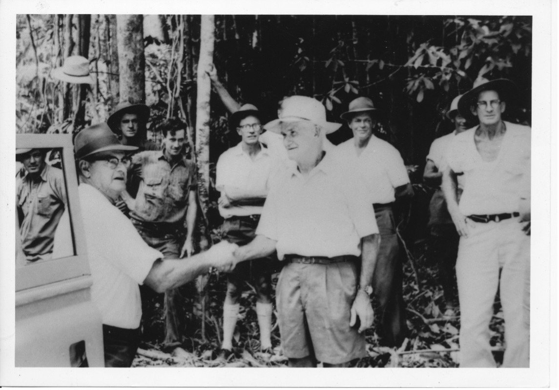
Opening of access road to Cape Tribulation, 1962 Cr EW Berzinski (Chairman of Douglas Shire Council) congratulating Andy Mason. Background: Unknown, E Palmer, R Hancock, Cr RDR Rex, HA Adair MLA, unknown, Cr EG Harlow

Adolph Polentz, E Mason, Rykers and plane (Image Supplied Lawrence Mason)

Timber Mill at Cape Tribulation (Image Supplied Lawrence Mason)

Mason’s Store, image supplied by Lawrence Mason.

Coral Coaches bus bogged in Cape Tribulation (Image Supplied Lawrence Mason)

Hayles boat in Cape Tribulation (Image Supplied Lawrence Mason)

Original house in Myall Creek (Image Supplied Lawrence Mason)

Paul Mason hosting his tour in Cape Tribulation (Image Supplied Lawrence Mason)